
Satellite investigation · Sea of Azov and Black Sea · July 2026
Crimea and the Kerch Strait have become a hub where russia’s military logistics overlap with one of the most vulnerable parts of the Azov–Black Sea basin. The satellite analysis of Operation Molochka examines whether strikes on this system led to mass vessel fires and a new oil catastrophe.
Crimea and the Kerch Strait may be the worst possible location for concentrating fuel logistics anywhere in the Azov–Black Sea region. The narrow, shallow strait connects two marine basins, while the direction of water exchange changes regularly. Pollution entering this area can spread into both the Sea of Azov and the Black Sea, join coastal circulation and reappear hundreds of kilometres from its source.
It is precisely in this environmentally sensitive area that russia concentrated ports, ferry crossings, fuel facilities and a mixed fleet supplying its southern military grouping through occupied Crimea. The July satellite series makes it possible to assess the environmental cost of striking this system.
Satellite analysis of Operation Molochka considers not individual tankers, cargo ships or barges, but the maritime link of a large transport-and-fuel system. Through ports and roadsteads in the Sea of Azov, the Kerch Strait, ferry crossings, warehouses and routes through occupied Crimea, russia sustains military flows on the southern axis.
In the spatial and dynamic analysis of the Kerch logistics hub the Green Leaf team previously showed that transport, fuel and support infrastructure operate here as a single system. Its military function is defined not by a port’s signboard or a vessel’s formal status, but by the flows passing through them. The same principle was formulated in the investigation of the Elektrostal fire: dual use is a property of logistics, not of a single building or vehicle.
For the Kerch hub, this logic carries an especially high environmental cost. Military-significant transport, fuel infrastructure and an ageing fleet are concentrated directly at the hydrodynamic transition between the Sea of Azov and the Black Sea. An accident or rupture of cargo tanks at such a location does not remain local: the substance enters existing natural flows and can be carried far beyond the initial site. The Volgoneft tanker disaster demonstrated this in practice, when heavy fuel oil from the strait was later recorded on the Ukrainian coast.
Environmental vulnerability clearly did not constrain russia when it built this logistics model. On the contrary, civilian ports, merchant vessels, fuel facilities and military flows were brought as close together as possible to make supply routes more resilient. The resulting risk was transferred to both marine basins, their coastal ecosystems and the people living along their shores.
The figure of 201 vessels hit therefore requires an environmental as well as a military reading. The central question is whether an operation of this scale meant dozens of burning tankers, breached cargo tanks and large fields of petroleum products, or whether the strikes mainly removed vessels from the logistics chain without destroying their cargo on a mass scale.
To answer it, the Green Leaf research group and the National Ecological Centre of Ukraine analysed the entire key area: the western Sea of Azov near the Kerch Strait, Temryuk Bay, the Kamennyi Cape area and the roadstead off Primorsko-Akhtarsk. Regional maps show numerous fires on land and around ports, but this investigation focuses on a narrower and more fundamental question: the degree of damage to vessels and the environmental footprint of the maritime part of the operation.
The time series made it possible to isolate two vessel-related episodes and several zones of surface oil pollution. Their relationship to the reported scale of the operation allows the military effect and the environmental cost to be assessed separately.
The assessment used NASA FIRMS thermal detections, Sentinel-2 optical scenes and Sentinel-1 radar imagery from 6 to 27 July. Surface oil pollution was identified using an integrated methodology combining radar detection, optical verification, meteorological correction and analysis of slick movement.
The methodology is described in a scientific paper by Vladyslav Balinskyi, Ruslan Havryliuk, Vitalii Hulevets and Mihaela Timofti: DOI 10.20535/EHS2710-3315.2025.332100. Ambiguous signatures were excluded from the evidence series. Some real slicks may therefore have gone undetected, but the objects presented below are classified as confirmed surface oil pollution.
Satellite analysis of Operation Molochka: the regional picture
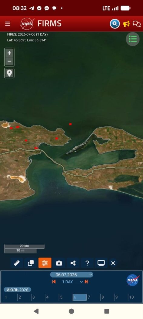
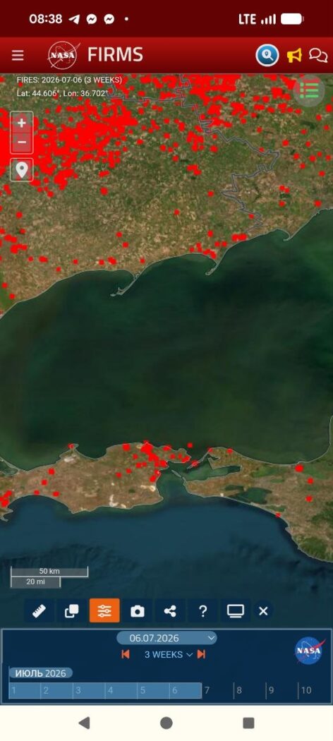
Three NASA FIRMS frames show the same western sector of the Sea of Azov. The one-day scene for 6 July already records a thermal signature at sea. The cumulative view for 6–27 July overlays every thermal event in the interval: many appear on land and near ports, while only one source remains at sea in this sector. The 21 July frame captures the final phase of its thermal activity.
6 July · one day
6–27 July · three weeks
21 July · one day
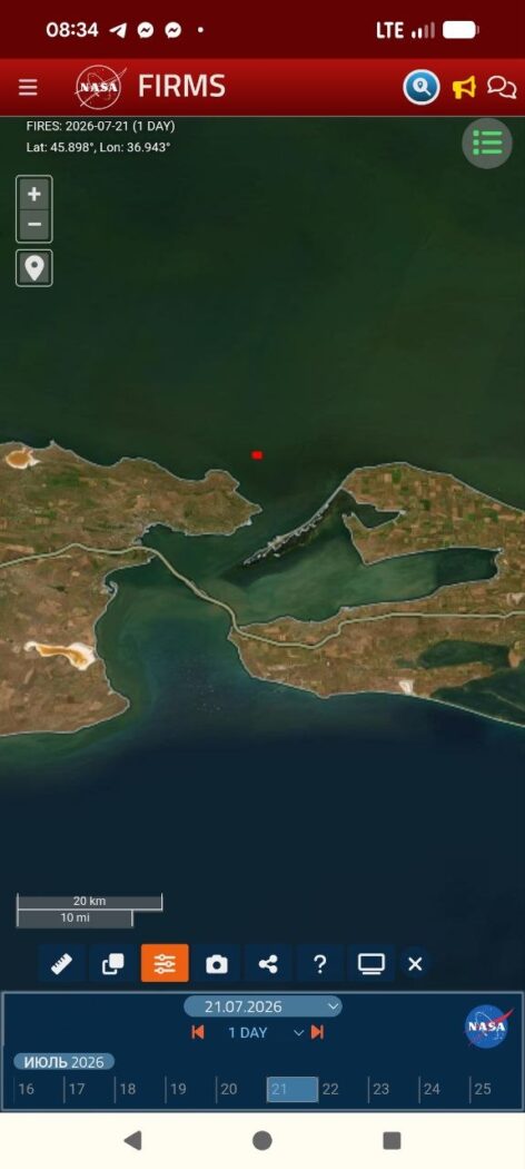
FIRMS does not prove uninterrupted burning minute by minute, but it records repeated thermal activity at the same location from 6 to 21 July. Within the marine sector examined, this is the only prolonged source of its kind.
The same object was located in Sentinel-2 optical imagery. The 8 and 11 July frames show a vessel and a smoke plume at this point. In the 21 July image the vessel remains in place but is no longer burning or emitting smoke. The final FIRMS detection and the 21 July optical frame are not contradictory: the satellites passed over the area at different times, so FIRMS may have recorded the final phase of the fire several hours before the optical image.
8 July · Sentinel-2
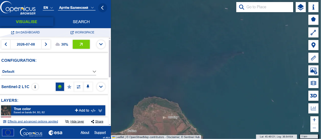
11 July · Sentinel-2
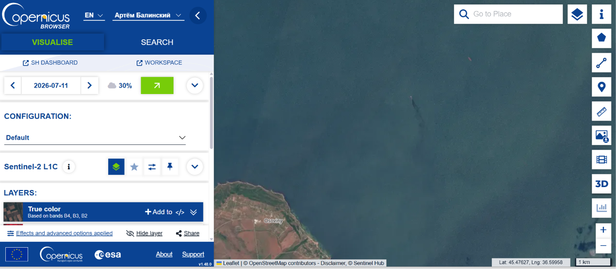
21 July · Sentinel-2
Confirmed pollution: Temryuk Bay, Kamennyi Cape and Primorsko-Akhtarsk
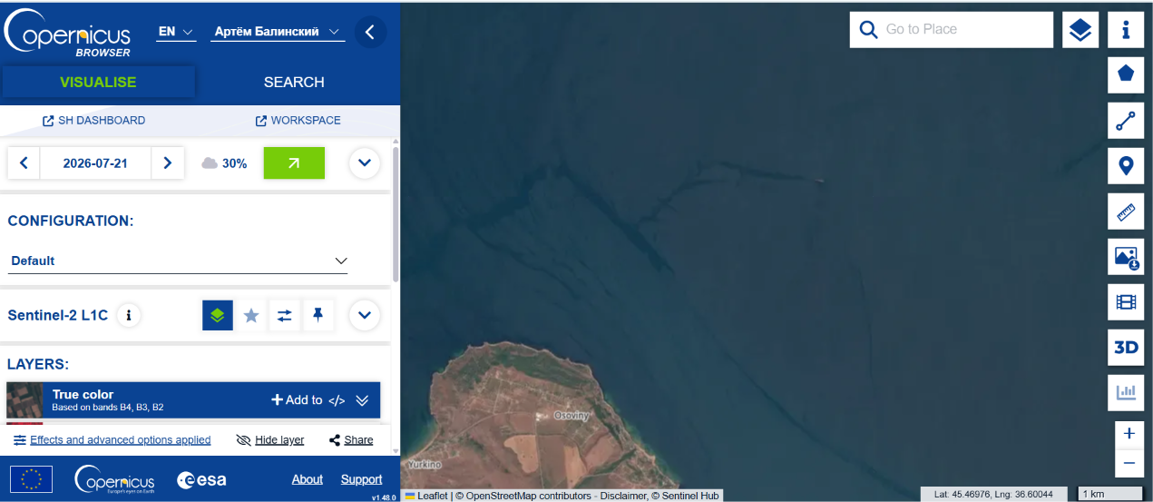
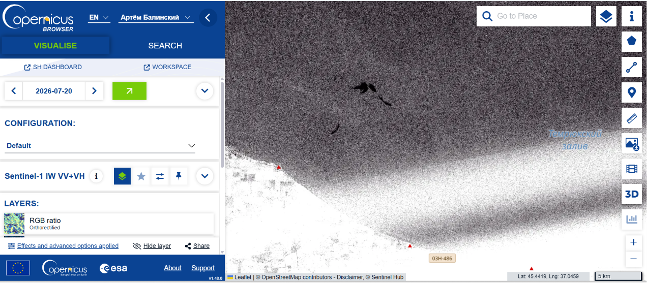
Radar scenes reveal another part of the picture — not fire, but oil films on the sea surface. In Temryuk Bay they form a separate time series. The pollution itself and its movement are confirmed, but without additional data each slick cannot be attributed to the vessel in the preceding episode.
In Sentinel-1 imagery, the configuration of the slicks changes between 8, 12, 14 and 20 July, while the main plumes shift eastward. In individual frames their measured lengths are approximately 13.07 and 5.37 kilometres.
8 July · Sentinel-1
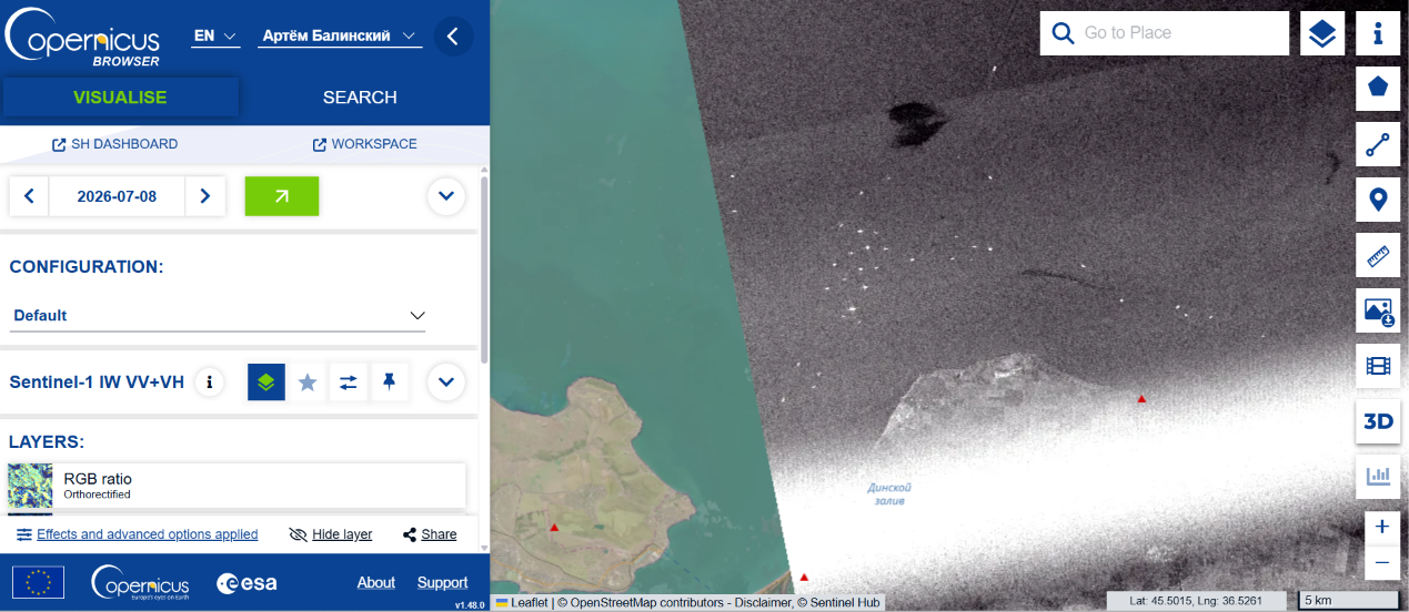
12 July · 13.07 km
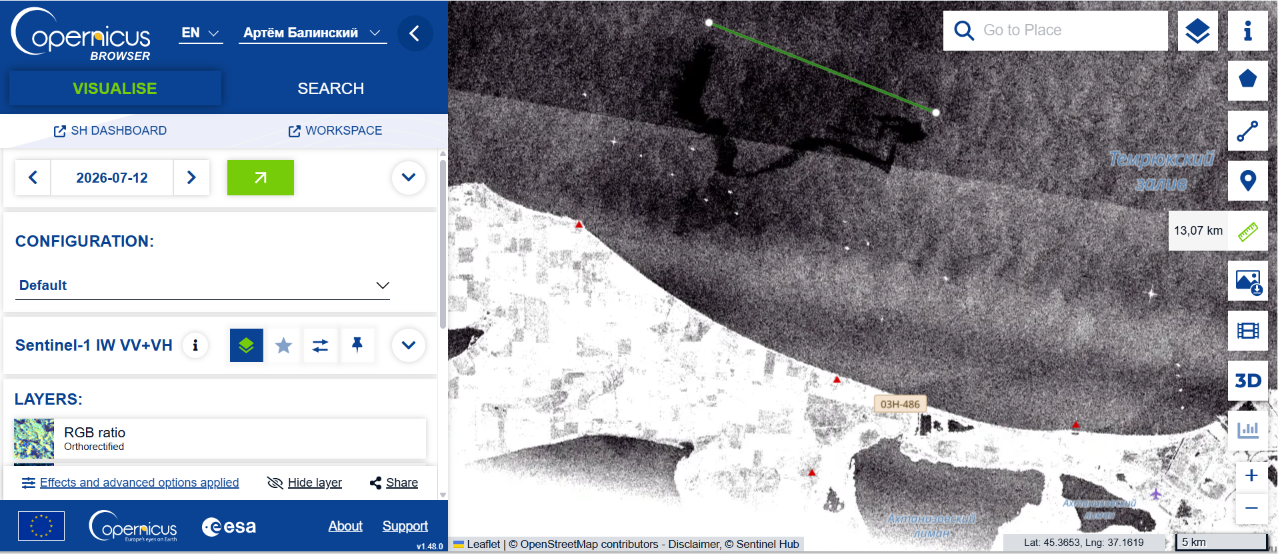
14 July · 5.37 km
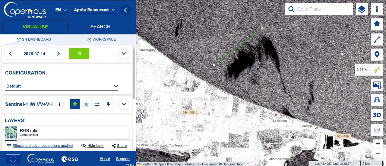
20 July · Sentinel-1
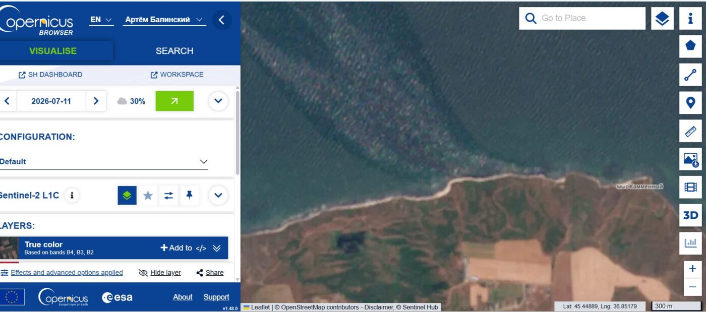
Another confirmed episode appears in the 11 July optical frames near Kamennyi Cape. The overview and enlarged image show an elongated area of surface pollution. These frames are important as an independent record, but they should not be tied to a specific vessel or automatically folded into the history of the first source near the Kerch Strait.
Kamennyi Cape · overview
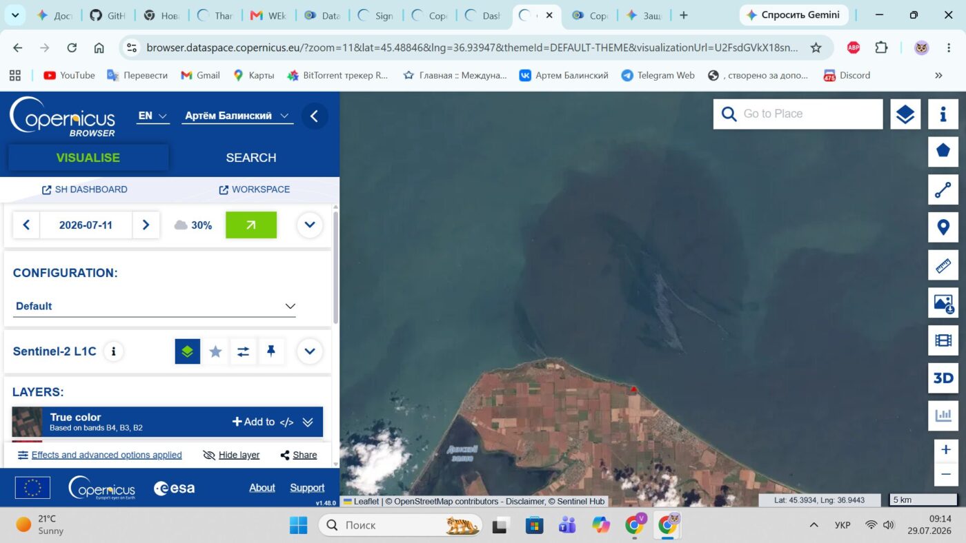
Kamennyi Cape · enlarged view
A separate vessel-related episode unfolded much farther east, off Primorsko-Akhtarsk. A Sentinel-2 optical image from 11 July shows a vessel with a substantial smoke plume. This is a different object, unrelated to the prolonged source near the Kerch Strait.
11 July · overview
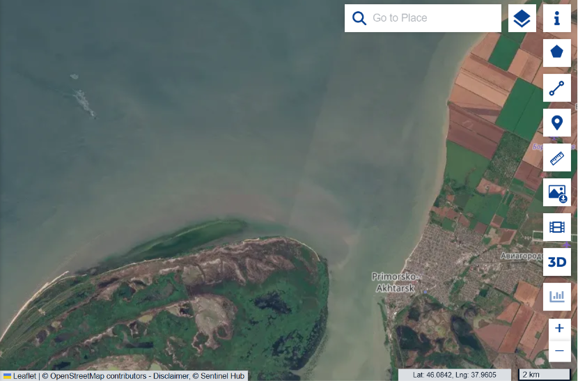
11 July · enlarged view
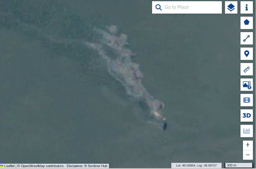
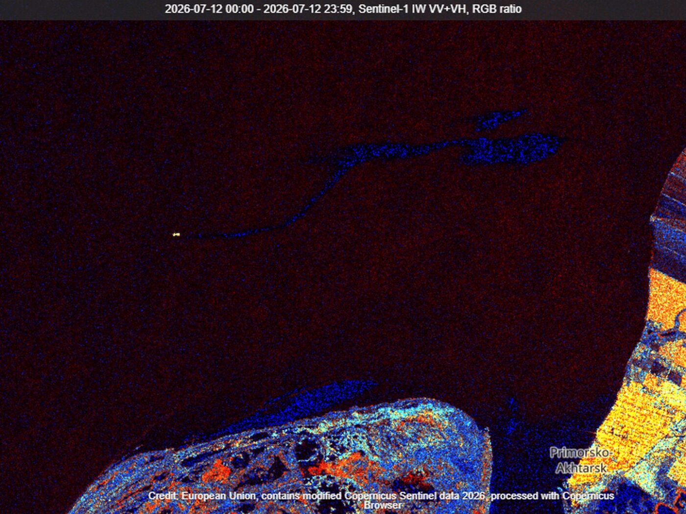
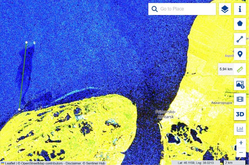
By 12 July the smoke plume had disappeared, but the environmental episode was not over. A close Sentinel-1 radar frame already shows confirmed surface oil pollution beside the vessel.
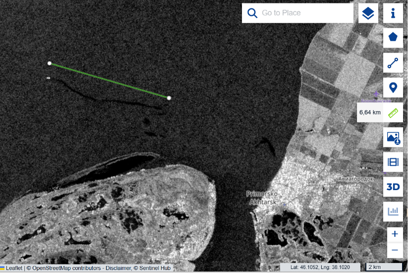
The release continues in subsequent scenes. On 14 July one slick measured about 6.64 kilometres. In the final available frame, dated 26 July, a plume about 5.94 kilometres long remained beside the same vessel. Within the analysed series, the pollution therefore persisted from at least 11 to 26 July.
14 July · 6.64 km
26 July · 5.94 km
What the ratio of fires and spills reveals about the nature of the operation
When the episodes are viewed at regional scale, the chronology forms a coherent system: a prolonged source near the Kerch Strait, a second vessel off Primorsko-Akhtarsk, and separate pollution events in Temryuk Bay and near Kamennyi Cape. Port and land fires remain a prominent backdrop to the operation, but the maritime component has a different structure.
Both vessels appear to be roughly one hundred metres long. This is consistent with the class of river–sea tankers and product carriers used in the Sea of Azov basin. Reports on the operation named vessels in the same size range, including Sanar-1, Venera-3, Penelope, Chelsea-6 and others. Such ships can therefore be treated as a pool of possible candidates, but the resolution of open imagery does not allow a specific vessel to be identified without AIS, port records or higher-resolution images.
According to the Unmanned Systems Forces, 129 vessels were hit in the Sea of Azov. Against that figure, one prolonged marine source, a second brief smoke event and several local spills are not a minor detail but the central result of the comparison. The mass rupture of cargo tanks on dozens of tankers would have left a fundamentally different signature in the satellite data.
What is visible is consistent with the declared tactic of Ukraine’s Unmanned Systems Forces: depriving vessels of navigation, control and propulsion without turning every strike into a sinking tanker. A satellite cannot see the precise impact point and cannot prove the method used against every vessel. It records the outcome: transport units leave the logistics chain, while the environmental harm, though real, does not grow into a cascading oil catastrophe.
The satellite data do not make this operation “environmentally clean”. They show something different: the harm was localised, while the strike on russian maritime logistics was regional.
The logistical effect of the operation is clearer than an environmental catastrophe. Vessels left roadsteads, reduced their visible activity and concentrated closer to ports and coastal protection. It was this system that carried fuel and military cargo through the Sea of Azov and occupied Crimea.
Two contrasts: Golden Leo and the Volgoneft tankers
The difference between striking military logistics and terror against civilian shipping was expressed most starkly in the Black Sea that same July.
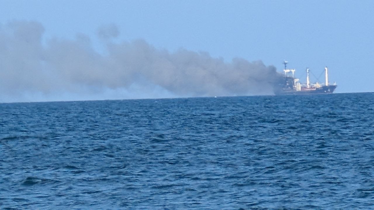
On 19 July, russia attacked the civilian grain carrier Golden Leo with three Kh-59/Kh-69 cruise missiles. One struck the starboard superstructure and a fire broke out aboard the ship. Nine crew members and a Ukrainian pilot were killed; eight people were rescued. The search-and-rescue operation continued throughout the night under the constant threat of further russian strikes. The Ukrainian Navy described the attack as an act of terror against peaceful shipping. A week later, Golden Leo sank. There is no room here for neutral euphemisms: three missiles were launched at an unarmed ship loaded with corn, and ten human lives were taken.
The history of the Volgoneft tankers provides another contrast. This is no longer a story of local slicks, but of the systemic danger posed by russia’s ageing oil-tanker fleet.
russia’s system for transporting petroleum products through the Sea of Azov and the Kerch Strait was dangerous long before the present war. On 11 November 2007, the tanker Volgoneft-139 broke apart in a storm. More than 1,300 tonnes of heavy fuel oil entered the sea, pollution affected the coast and adjacent waters, and dead and affected birds were counted in the thousands.
In December 2024, the scenario was repeated with Volgoneft-212 and Volgoneft-239. Thousands of tonnes of heavy fuel oil entered the sea, struck the Anapa area and began spreading along the coast. Field and satellite research traced the pollution for at least 600 kilometres to Odesa Region.
These were not random accidents involving isolated ships. Engineer Gennadiy Yegorov warned for years about systemic risks in ageing Volgoneft tankers: corrosion, metal fatigue, inadequate structural margins and dangerous hull conversions. His analysis covered 169 accidents and disasters.
russia’s shadow and auxiliary fleet is therefore dangerous not only as military logistics. The sheer number of ageing tankers, barges and product carriers in a shallow, semi-enclosed sea creates a disaster risk that could exceed the local July releases by hundreds of times.
From satellite observation to evidence
All July episodes are to be added to the Black Sea Environmental Evidence Platform. Each event is assigned a date, coordinates, original imagery, the observation method, an interpretation and clearly stated limits of confidence.
This is especially important for the present investigation. The first vessel-related episode, the pollution in Temryuk Bay, the separate optical episode near Kamennyi Cape and the vessel off Primorsko-Akhtarsk must exist on the map as distinct evidence objects rather than as a single blended narrative.
The Platform does not claim to be a complete register of every pollution event. Conservative selection reduces the risk of false positives, but it also means that some real slicks may have remained outside observation. Every included episode can nevertheless be checked against the original frames and revisited when new AIS records or higher-resolution imagery become available.

Satellite analysis of Operation Molochka answers not how many vessels were hit, but what happened to the sea afterwards. The answer cannot be reduced to the word “safe”: one vessel burned for an extended period, another remained a source of petroleum products until at least 26 July, and individual slicks stretched for many kilometres.
At the same time, against the scale of 129 reported strikes, the satellite picture does not resemble the mass breaching of cargo tanks or a series of tanker sinkings. It points to a major logistical effect and a localised environmental footprint. This does not excuse any spill; it records the difference between harm that was constrained and a catastrophe that could have engulfed both marine basins.
That difference is especially stark beside russian practice: the ageing and accident-prone Volgoneft fleet, strikes on Ukrainian ports, and three cruise missiles fired at Golden Leo. In every case the sea becomes a hostage to war. The task of open satellite monitoring is not to strip that emotion from the text, but to support it with evidence that can be checked.
Sources and related material
- Suspilne Crimea: Robert Brovdi’s statement on 201 vessels hit.
- Reuters Graphics: changes in shipping in the Sea of Azov and the Kerch Strait.
- UNN: declared tactic of disabling vessels without breaching cargo tanks.
- Ukrainska Pravda: vessels named as hit at the start of the operation.
- Reuters: russian strike on the Golden Leo bulk carrier and the deaths of ten people.
- Reuters: Golden Leo sank one week after the strike.
- The Maritime Executive: the Golden Leo rescue operation under threat of further strikes
- UNEP: assessment of the 2007 Volgoneft-139 accident in the Kerch Strait.
- Green Leaf: engineering warnings about Volgoneft tankers.
- Green Leaf: heavy fuel oil spill and consequences for the Black Sea ecosystem.
- Field research in Tuzly Lagoons National Nature Park: heavy fuel oil, war debris and cetacean deaths.
- Green Leaf: 900 km² of the Black Sea affected after a russian strike on vegetable-oil tanks.
- KPI: Integrated methodology for tracing oil slicks using Sentinel-1 and Sentinel-2 data.
- DOI for the scientific paper on the integrated methodology.
- Environmental Evidence Platform: interactive map of pollution and damage in the Black Sea.
- Full scientific and methodological description of the Environmental Evidence Platform.
Monitoring and preparation of evidentiary material are carried out through cooperation between the Green Leaf NGO, the National Ecological Centre of Ukraine and Tuzly Lagoons National Nature Park, with support from Deutsche Bundesstiftung Umwelt (DBU). The scientific content, interpretations and conclusions are the responsibility of the authors and participating organisations and do not necessarily reflect the position of DBU.
Close Sentinel-1 radar image from 12 July: the vessel off Primorsko-Akhtarsk and surface oil pollution extending from it. Copernicus Sentinel data. Analysis: Vladyslav Balinskyi.
The bulk carrier Golden Leo after a russian missile strike in the Black Sea on 19 July 2026. A prolonged smoke plume is visible on the horizon. Photo: Vladyslav Balinskyi.
Certificate of Vladyslav Balinskyi’s participation in the 25th International Science Conference “Ecology. Human. Society”, where he presented the integrated methodology for tracing oil slicks using Sentinel-1 and Sentinel-2 data. Kyiv, 12 June 2025.